ISRO’S NVS-02 MISSION
The Indian Space Research Organisation (ISRO) faced a setback in its mission to place the NVS-02 satellite into its designated orbit after the satellite’s thrusters failed to ignite. This issue prevented the necessary orbit adjustment.
- What Went Wrong: The thrusters, which are meant to raise the satellite’s orbit, could not be fired because the valves needed to release the oxidizer didn’t open.
- This meant that the planned operations to place the satellite in its correct orbit could not be carried out.
- Current Status: Although the satellite is now in an elliptical orbit, which is not ideal for its intended function, ISRO is now looking into alternative mission strategies.
- They are working to figure out how to use the satellite for navigation in this orbit.
KEY POINTS
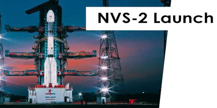
- Launch Details: The NVS-02 satellite, which is a key part of India’s NavIC system (Navigation with Indian Constellation), was launched on January 29.
- It was carried aboard the GSLV-Mk 2 rocket and marked a significant milestone for ISRO as it was their 100th launch from the Sriharikota spaceport.
- Current Position: After the launch, the satellite was successfully placed in a Geosynchronous Transfer Orbit (GTO), an elliptical orbit, which is not ideal for NavIC.
- This orbit isn’t suitable for the satellite’s navigation system, which is why the orbit raising operation didn’t go as planned.
WHAT WENT WELL?
- Even though the thrusters failed to fire, there were several positive aspects of the mission:
- The satellite’s solar panels deployed as expected.
- Power generation has been stable.
- Communication between the satellite and the ground station was successfully established.
- ISRO confirmed that the launch was a success, with the rocket’s stages performing perfectly and the satellite reaching the initial orbit with high precision.
WHAT’S NEXT FOR NVS-02?
- The NVS-02 satellite is the 2nd in India’s next-generation NavIC
- This regional navigation system is designed to provide precise positioning, velocity, and timing information to users across India and up to 1,500 km beyond its borders.
- Despite the current orbit issues, NVS-02 will still enhance the NavIC system, helping with various applications like:
- Navigation
- Precision agriculture
- Emergency response
- Fleet management
- Mobile device location services
- The satellite features an advanced navigation payload that operates on three frequency bands (L1, L5, and S), ensuring high accuracy.
ABOUT NAVIC
NavIC is India’s regional navigation satellite system, developed by ISRO to provide accurate Position, Velocity, and Timing (PVT) services within India and up to 1,500 km beyond its borders. It is designed to serve a variety of applications, including transportation, surveying, and scientific research.

THE NAVIC SYSTEM
- Constellation of 7 Satellites: 3 satellites in geostationary orbit at 32.5°E, 83°E, and 129.5°E;
- 4 satellites in inclined geosynchronous orbit at 55°E and 111.75°E with an inclination of 29°.
- Ground Network: Consisting of a control centre, precise timing facility, range and integrity monitoring stations, and two-way ranging stations.
- Accuracy: Provides positioning accuracy better than 10 m throughout India and 20 m in the surrounding 1,500 km area. Timing accuracy is better than 50 nanoseconds.
- Services: NavIC offers 2 services – Standard Position Service (SPS) for civilians and Restricted Service (RS) for strategic users, available in both L5 (1176.45 MHz) and S bands (2498.028 MHz).
APPLICATION OF NAVIC
- Transportation (terrestrial, aerial, and marine)
- Location-based services
- Personal mobility
- Resource monitoring
- Surveying and geodesy
- Scientific research
- Time dissemination and synchronization
- Safety-of-life alert dissemination
Note: Connect with Vajirao & Reddy Institute to keep yourself updated with latest UPSC Current Affairs in English.
Note: We upload Current Affairs Except Sunday.